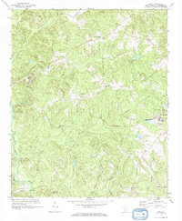
1969 Map of Rion
USGS Topo · Published 1973About this map
Rion serves as a focal point in this Fairfield County landscape, where the granite industry is marked by numerous Quarries and the route of the Rockton and Rion railroad. This 1969 field-checked survey reveals a rural society deeply rooted in its local institutions, evidenced by a dense network of country churches including Union Memorial Ch, Shiloh Ch, and Mt Zion Ch. The terrain is defined by the Little River and its many tributaries like Mill Creek and Morris Creek, which carve through the wooded hills. Small settlements and named crossroads such as Milling Crossroads and Macafee anchor the community, while the Kelly Miller Sch stands as a notable landmark for those tracing local educational history during the late 1960s.
Find a feature on this map
32 named features on this map. Tap any name to fly to it.
Don’t see what you’re looking for? This feature index may not catch every label — zoom into the map to look around manually.
Map Details
Editions of this 1969 Rion Map
This is the sole edition of this map. No revisions or reprints were ever made.
Other maps of this area

1904 · Columbia
USGS Topo · 1:125,000

1941 · Spartanburg
USGS Topo · 1:250,000

1947 · Richtex
USGS Topo · 1:24,000

1949 · Richtex
USGS Topo · 1:24,000

1949 · Irmo NE
USGS Topo · 1:24,000

1953 · Spartanburg
USGS Topo · 1:250,000

1960 · Spartanburg
USGS Topo · 1:250,000

1963 · Spartanburg
USGS Topo · 1:250,000

1964 · Spartanburg
USGS Topo · 1:250,000

1969 · Lebanon
USGS Topo · 1:24,000