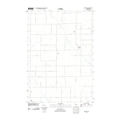
2010 Map of Riplinger
USGS Topo · Published 2010About this map
Riplinger sits at the heart of this rural Clark County landscape, where a dense grid of farm-to-market roads defines the community structure. The drainage patterns of the South Fork Popple River and Nelson Creek move through the northern sections, while the Rock Creek and Yellow River headwaters influence the southern terrain. This area is notably rich in genealogical sites, with several consecrated grounds serving the local population, including Saint Johns Cemetery, Beaver Cemetery, Trinity Cemetery, and Saint Anthony Cemetery. The road network, consisting of thoroughfares like County Hwy-K and Riplinger Rd, reflects a persistent agricultural layout that has remained stable into the early 21st century, providing a clear view of the property lines and rural intersections that have supported this Wisconsin farming region for generations.
Find a feature on this map
38 named features on this map. Tap any name to fly to it.
Don’t see what you’re looking for? This feature index may not catch every label — zoom into the map to look around manually.
Map Details
Editions of this 2010 Riplinger Map
This is the sole edition of this map. No revisions or reprints were ever made.
Other maps of this area

1953 · Neillsville
USGS Topo · 1:62,500

1953 · Abbotsford
USGS Topo · 1:48,000

1953 · Owen
USGS Topo · 1:48,000

1953 · Eau Claire
USGS Topo · 1:250,000

1954 · Granton
USGS Topo · 1:62,500

1958 · Eau Claire
USGS Topo · 1:250,000

1963 · Abbotsford
USGS Topo · 1:62,500

1963 · Owen
USGS Topo · 1:62,500

1964 · Eau Claire
USGS Topo · 1:250,000
1979 · Loyal East
USGS Topo · 1:24,000