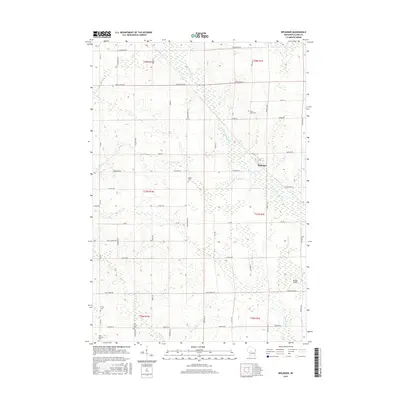
2015 Map of Riplinger
USGS Topo · Published 2015About this map
Riplinger and Beaver anchor this section of central Wisconsin, where the headwaters of the S Fork Popple River and the Yellow River begin their southward journeys. The landscape is characterized by its agricultural grid, punctuated by a series of family and community burial grounds including Saint Johns Cem and Trinity Cem. The topography reveals the intricate drainage patterns of the region, with Nelson Cr and Rock Cr carving through the terrain near established farmsteads and rural intersections. Near the town of Riplinger, the Stoiber Airport represents a more contemporary addition to this largely traditional landscape. Genealogists and local historians will find the detailed road network, from Popple River Rd to Spencer Rd, essential for locating ancestral properties and historic rural centers.
Find a feature on this map
49 named features on this map. Tap any name to fly to it.
Don’t see what you’re looking for? This feature index may not catch every label — zoom into the map to look around manually.
Map Details
Editions of this 2015 Riplinger Map
This is the sole edition of this map. No revisions or reprints were ever made.
Other maps of this area

1953 · Neillsville
USGS Topo · 1:62,500

1953 · Abbotsford
USGS Topo · 1:48,000

1953 · Owen
USGS Topo · 1:48,000

1953 · Eau Claire
USGS Topo · 1:250,000

1954 · Granton
USGS Topo · 1:62,500

1958 · Eau Claire
USGS Topo · 1:250,000

1963 · Abbotsford
USGS Topo · 1:62,500

1963 · Owen
USGS Topo · 1:62,500

1964 · Eau Claire
USGS Topo · 1:250,000
1979 · Loyal East
USGS Topo · 1:24,000