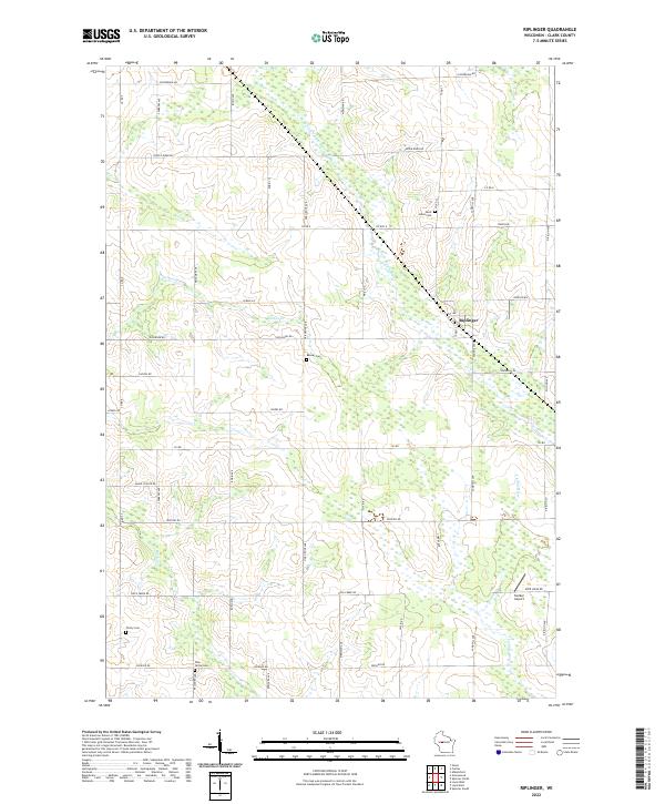
2022 Map of Riplinger
USGS Topo · Published 2022About this map
The unincorporated community of Riplinger sits at the intersection of 1st Ave and Co Rd Q, serving as a central point in this rural Clark County landscape. The area is defined by its small community cemeteries, including Saint Johns Cem and Beaver Cem, which reflect the generations of family farming that shaped the local townships. The terrain is characterized by a low-lying drainage network, where the South Fork Popple River and Nelson Cr meander through sections of forest and wetland.
Find a feature on this map
49 named features on this map. Tap any name to fly to it.
Don’t see what you’re looking for? This feature index may not catch every label — zoom into the map to look around manually.
Map Details
Editions of this 2022 Riplinger Map
This is the sole edition of this map. No revisions or reprints were ever made.
Other maps of this area

1953 · Neillsville
USGS Topo · 1:62,500

1953 · Abbotsford
USGS Topo · 1:48,000

1953 · Owen
USGS Topo · 1:48,000

1953 · Eau Claire
USGS Topo · 1:250,000

1954 · Granton
USGS Topo · 1:62,500

1958 · Eau Claire
USGS Topo · 1:250,000

1963 · Abbotsford
USGS Topo · 1:62,500

1963 · Owen
USGS Topo · 1:62,500

1964 · Eau Claire
USGS Topo · 1:250,000
1979 · Loyal East
USGS Topo · 1:24,000