
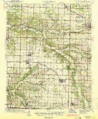
1943 Map of Ritchey
USGS Topo · Published 1943About this map
Shoal Creek and the St Louis San Francisco RR define the northern corridor of this Southwest Missouri landscape, where industrial activity and agricultural settlements overlap. The map reveals a high concentration of localized mining activity, particularly near Newtonia and Pulaskifield, including the Dungy Mine and the Polish Queen Mine. The southwestern corner is dominated by the Camp Crowder Military Reservation, signaling the area's strategic importance during the early 1940s.
Find a feature on this map
110 named features on this map. Tap any name to fly to it.
Don’t see what you’re looking for? This feature index may not catch every label — zoom into the map to look around manually.
Map Details
Editions of this 1943 Ritchey Map
2 editions found
Other maps of this area

1886 · Greenfield
USGS Topo · 1:125,000

1886 · Carthage
USGS Topo · 1:125,000

1888 · Greenfield
USGS Topo · 1:125,000

1894 · Carthage
USGS Topo · 1:125,000

1916 · Neosho
USGS Topo · 1:62,500

1921 · Stotts City
USGS Topo · 1:62,500

1921 · Sarcoxie
USGS Topo · 1:62,500

1937 · Cassville
USGS Topo · 1:48,000

1940 · Noel
USGS Topo · 1:62,500

1941 · Rocky Comfort
USGS Topo · 1:62,500