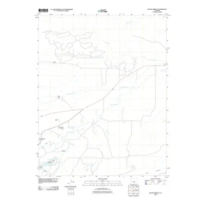
2010 Map of Ritter Arroyo
USGS Topo · Published 2010About this map
La Veta anchors the southwestern corner of this Huerfano County landscape, where the Cucharas River and Wahatoya Creek converge before winding northeast toward the Great Plains. The topography is defined by the transition from the base of the mountains at Pinon Hill to the arroyo-cut lowlands, including the eponymous Ritter Arroyo and Pictou Arroyo. This 2010 survey illustrates a complex water management system essential to the high desert, featuring the Daigre Reservoir, Wahatoya Lake Reservoir, and several agricultural improvements like the Shearer Dam and J O Smith and Sons Number 1 Dam. Genealogists will find significant value in the documentation of local burial grounds, including the Old La Veta Cemetery, the primary La Veta Cemetery, and the more secluded Chavez Cemetery located near the northern arroyos.
Find a feature on this map
26 named features on this map. Tap any name to fly to it.
Don’t see what you’re looking for? This feature index may not catch every label — zoom into the map to look around manually.
Map Details
Editions of this 2010 Ritter Arroyo Map
This is the sole edition of this map. No revisions or reprints were ever made.
Other maps of this area

1889 · Huerfano Park
USGS Topo · 1:125,000

1891 · Walsenburg
USGS Topo · 1:125,000

1891 · Spanish Peaks
USGS Topo · 1:125,000

1892 · Huerfano Park
USGS Topo · 1:125,000

1893 · Spanish Peaks
USGS Topo · 1:125,000

1894 · Walsenburg
USGS Topo · 1:125,000

1895 · Spanish Peaks
USGS Topo · 1:125,000

1897 · Walsenburg
USGS Topo · 1:125,000

1897 · Spanish Peaks
USGS Topo · 1:125,000

1900 · Spanish Peaks
USGS Topo · 1:125,000