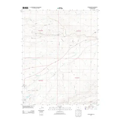
2013 Map of Ritter Arroyo
USGS Topo · Published 2013About this map
La Veta serves as the focal point for this landscape where the Cucharas River and Wahatoya Cr converge near the Sangre de Cristo foothills. The town's historical depth is marked by the presence of both the La Veta Cem and the Old La Veta Cem, suggesting shifts in the local community over generations. The terrain is defined by irrigation and water management, visible in the network of the Lake Merriam Ditch and several private catchments like the J O Smith and Sons Reservoir and Shearer Reservoir. To the northeast, the distinct geological formation of The Hogback rises above the drainage of Pietou Arroyo and Sand Arroyo. Transport and recreation are anchored by the La Veta Municipal Airport and the scenic Co-12 highway, while the higher ground to the south features Wahatoya Lake Reservoir and Daigre Reservoir at the base of Pinon Hill.
Find a feature on this map
58 named features on this map. Tap any name to fly to it.
Don’t see what you’re looking for? This feature index may not catch every label — zoom into the map to look around manually.
Map Details
Editions of this 2013 Ritter Arroyo Map
This is the sole edition of this map. No revisions or reprints were ever made.
Other maps of this area

1889 · Huerfano Park
USGS Topo · 1:125,000

1891 · Walsenburg
USGS Topo · 1:125,000

1891 · Spanish Peaks
USGS Topo · 1:125,000

1892 · Huerfano Park
USGS Topo · 1:125,000

1893 · Spanish Peaks
USGS Topo · 1:125,000

1894 · Walsenburg
USGS Topo · 1:125,000

1895 · Spanish Peaks
USGS Topo · 1:125,000

1897 · Walsenburg
USGS Topo · 1:125,000

1897 · Spanish Peaks
USGS Topo · 1:125,000

1900 · Spanish Peaks
USGS Topo · 1:125,000