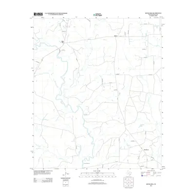
2013 Map of River Hill
USGS Topo · Published 2013About this map
The Sabine River carves a winding path through the heart of this Panola County landscape, defining the local geography with its complex network of oxbows and backwaters. Small settlements like Deadwood, River Hill, and Midyett dot the region, connected by a web of rural farm-to-market roads and county routes. The terrain is notably defined by its hydrology, where features such as Fish Lake Slough, Hoggs Bayou, and Hill Lake suggest a bottomland environment prone to seasonal shifts.
Find a feature on this map
48 named features on this map. Tap any name to fly to it.
Don’t see what you’re looking for? This feature index may not catch every label — zoom into the map to look around manually.
Map Details
Editions of this 2013 River Hill Map
This is the sole edition of this map. No revisions or reprints were ever made.
Other maps of this area

1943 · Waskom
USGS Topo · 1:62,500

1945 · Waskom
USGS Topo · 1:62,500

1945 · Socagee Bayou
USGS Topo · 1:62,500

1956 · Tyler
USGS Topo · 1:250,000

1956 · Deadwood
USGS Topo · 1:62,500

1958 · Darco
USGS Topo · 1:62,500

1958 · Carthage
USGS Topo · 1:62,500

1962 · De Berry
USGS Topo · 1:24,000
1962 · Panola
USGS Topo · 1:24,000

1983 · Grand Bluff
USGS Topo · 1:24,000