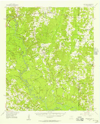
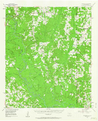
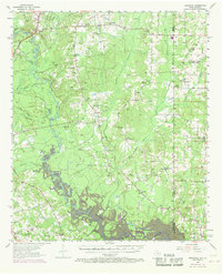
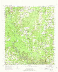
1956 Map of Deadwood
USGS Topo · Published 1957About this map
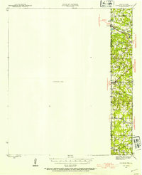
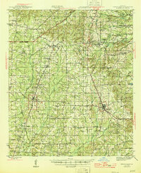
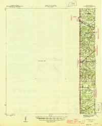
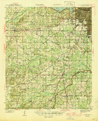
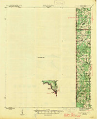
The Sabine River forms the winding boundary between Texas and Louisiana in this mid-1950s survey, anchoring a landscape defined by small rural communities and extensive energy infrastructure. The Carthage Gas Field dominates the western half of the map, marked by a dense network of pipelines and pumping stations that cut across the local hydrology of Murvaul Creek and Wilkerson Creek. This intersection of industrial growth and rural tradition is evident in the cluster of landmarks near Deadwood, where several family cemeteries and country churches, such as Saint Rest Ch and Bethlehem Ch, remain central to the settlement pattern.
Find a feature on this map
53 named features on this map. Tap any name to fly to it.
Don’t see what you’re looking for? This feature index may not catch every label — zoom into the map to look around manually.
Map Details
Editions of this 1956 Deadwood Map
4 editions found
Other maps of this area
1943 · Waskom
USGS Topo · 1:62,500

1944 · Logansport
USGS Topo · 1:62,500
1945 · Grand Cane
USGS Topo · 1:62,500
1945 · Waskom
USGS Topo · 1:62,500
1945 · Greenwood
USGS Topo · 1:62,500
1945 · Socagee Bayou
USGS Topo · 1:62,500

1953 · Alexandria
USGS Topo · 1:250,000

1953 · Palestine
USGS Topo · 1:250,000

1955 · Shreveport
USGS Topo · 1:250,000

1955 · Alexandria
USGS Topo · 1:250,000