1944 Map of Logansport
USGS Topo · Published 1944About this map
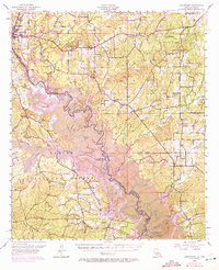
Sabine River serves as the winding border between Louisiana and Texas in the early 1940s, defining a landscape of dense bayous and small rural settlements. This survey, conducted by J. P. Rydeen and others, reveals the intricate drainage system of Grand Cane Bayou, Tenaha Bayou, and Cow Bayou before the large-scale impoundments of later decades. The area is dotted with numerous small churches and cemeteries, such as Prude Cem and New Bethany Ch, which reflect the localized nature of community life during this era.
Find a feature on this map
88 named features on this map. Tap any name to fly to it.
Don’t see what you’re looking for? This feature index may not catch every label — zoom into the map to look around manually.
Map Details
Editions of this 1944 Logansport Map
This is the sole edition of this map. No revisions or reprints were ever made.