
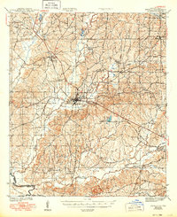
1944 Map of Zwolle
USGS Topo · Published 1944About this map
The Kansas City Southern railroad serves as the industrial spine of Sabine Parish in the mid-1940s, connecting the major timber and agricultural hubs of Noble and Zwolle. This period reveals a landscape transitioning through active resource extraction, marked by specific sites like the Sardis Gem and Parrott Gem. The map provides a detailed view of the rural social fabric of the era, anchoring communities around local institutions like San Patricio Ch, Shiloh Ch, and the Bansilene Sch. To the south and west, the terrain is defined by the Sabine River boundary and the protected woodlands of the Sabine National Forest. Numerous small drainage networks, including San Miguel Bayou and Bayou La Nana, dictate the placement of early settlements and roads, offering a clear record of the region’s topography before later 20th-century developments altered the local hydrology.
Find a feature on this map
43 named features on this map. Tap any name to fly to it.
Don’t see what you’re looking for? This feature index may not catch every label — zoom into the map to look around manually.
Map Details
Editions of this 1944 Zwolle Map
2 editions found
Other maps of this area

1938 · Hollis Creek
USGS Topo · 1:31,680

1941 · Zwolle
USGS Topo · 1:62,500

1941 · Pelican
USGS Topo · 1:62,500

1942 · Many
USGS Topo · 1:62,500

1942 · Florien
USGS Topo · 1:62,500

1943 · Many
USGS Topo · 1:62,500

1943 · Pleasant Hill
USGS Topo · 1:62,500

1944 · Negreet
USGS Topo · 1:62,500

1944 · Logansport
USGS Topo · 1:62,500

1944 · Patroon
USGS Topo · 1:62,500