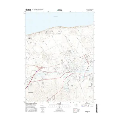
2016 Map of Riverhead
USGS Topo · Published 2016About this map
Riverhead sits at the western head of the Peconic estuary, where the Peconic River and its tributaries define the transition from the Long Island Sound's high bluffs to the bay-oriented plains. The landscape is marked by numerous freshwater bodies including Wildwood Lake, Peconic Lake, and Swan Pond, which sit south of the agricultural corridor along Sound Ave. In the early 21st century, this area maintains its distinctive settlement patterns, from the clustered hamlets of Baiting Hollow and Northville in the north to Riverside and Flanders in the south.
Find a feature on this map
168 named features on this map. Tap any name to fly to it.
Don’t see what you’re looking for? This feature index may not catch every label — zoom into the map to look around manually.
Map Details
Editions of this 2016 Riverhead Map
This is the sole edition of this map. No revisions or reprints were ever made.
Other maps of this area

1903 · Riverhead
USGS Topo · 1:62,500

1904 · Riverhead
USGS Topo · 1:62,500

1904 · Moriches
USGS Topo · 1:62,500

1943 · Riverhead
USGS Topo · 1:62,500

1947 · Mattituck
USGS Topo · 1:24,000

1947 · Mattituck Hills
USGS Topo · 1:24,000

1947 · Riverhead
USGS Topo · 1:24,000

1947 · Quogue
USGS Topo · 1:24,000

1947 · Eastport
USGS Topo · 1:24,000

1947 · Hartford
USGS Topo · 1:250,000