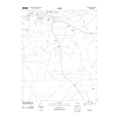
2010 Map of Rivermont
USGS Topo · Published 2010About this map
The Neuse River defines the northern reaches of this landscape just east of Kinston, where established settlements like Rivermont and Dupreeville meet the sprawling lowland drainage systems of the coastal plain. The terrain is a network of slow-moving waters and named swamps, including the expansive Southwest Creek and Vine Swamp, which dictate the placement of local roads and smaller communities such as Loftins Crossroads and Elm Grove.
Find a feature on this map
74 named features on this map. Tap any name to fly to it.
Don’t see what you’re looking for? This feature index may not catch every label — zoom into the map to look around manually.
Map Details
Editions of this 2010 Rivermont Map
This is the sole edition of this map. No revisions or reprints were ever made.
Other maps of this area

1902 · Ayden
USGS Topo · 1:62,500

1903 · Trent River
USGS Topo · 1:62,500

1904 · Ayden
USGS Topo · 1:62,500

1904 · Trent River
USGS Topo · 1:62,500

1914 · Kinston
USGS Topo · 1:48,000

1916 · Kinston
USGS Topo · 1:62,500

1953 · Rocky Mount
USGS Topo · 1:250,000

1954 · Rocky Mount
USGS Topo · 1:250,000

1958 · Deep Run
USGS Topo · 1:62,500
1980 · Pink Hill
USGS Topo · 1:24,000