
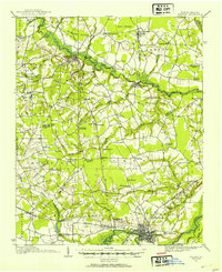
1914 Map of Kinston
USGS Topo · Published 1914About this map
Kinston serves as the industrial and transport hub of this 1914 landscape, situated where the Atlantic and North Carolina RR and Norfolk Southern RR converge near the Neuse River. The surrounding terrain is a network of tobacco and cotton lands, marked by significant pocosin wetlands like Bear Garden Pocoson and Rices Pocoson. The map meticulously records the rural social fabric of eastern North Carolina, from the State School for Feeble Minded west of the city to remote crossroads like Mewborns Crossroads and Glenfield Crossroads. Numerous small country institutions, such as Saints Delight Church, Jerusalem Church, and Harris Chapel School, provide a detailed view of family-centered landmarks that defined local life before the era of modern school consolidation and highway expansion.
Find a feature on this map
85 named features on this map. Tap any name to fly to it.
Don’t see what you’re looking for? This feature index may not catch every label — zoom into the map to look around manually.
Map Details
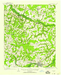
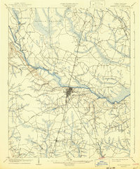
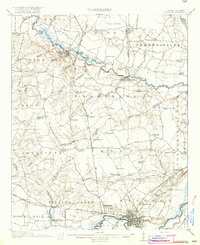
Editions of this 1914 Kinston Map
3 editions found
Other maps of this area

1902 · Ayden
USGS Topo · 1:62,500

1903 · Winterville
USGS Topo · 1:62,500

1903 · Trent River
USGS Topo · 1:62,500

1904 · Ayden
USGS Topo · 1:62,500

1904 · Trent River
USGS Topo · 1:62,500

1904 · Falkland
USGS Topo · 1:62,500

1904 · Wilson
USGS Topo · 1:62,500
1905 · Winterville
USGS Topo · 1:62,500
1916 · Kinston
USGS Topo · 1:62,500

1953 · Rocky Mount
USGS Topo · 1:250,000