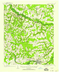
1914 Map of Kinston
USGS Topo · Published 1954About this map
Kinston serves as the focal point of this 1914 survey, situated along a sharp bend of the Neuse River where the Norfolk Southern RR and Atlantic Coast Line RR converge. The surrounding coastal plain of Lenoir and Greene counties is defined by an intricate network of wetlands and creeks, including the expansive Bull Head Swamp and the winding Contentnea Creek. The landscape is dotted with early 20th-century rural infrastructure, from the State School for Feeble Minded south of the city to numerous small community hubs like Glenfield Crossroads and Mewborns Crossroads. For the local historian, the map preserves the exact locations of vanished schoolhouses such as Tyndall School and Savannah School, alongside country congregations at Jerusalem Church and Union Chapel, offering a look at the region's social geography before the modern era of highway expansion and school consolidation.
Find a feature on this map
86 named features on this map. Tap any name to fly to it.
Don’t see what you’re looking for? This feature index may not catch every label — zoom into the map to look around manually.
Map Details
Editions of this 1914 Kinston Map
3 editions found
Other maps of this area

1902 · Ayden
USGS Topo · 1:62,500

1903 · Winterville
USGS Topo · 1:62,500

1903 · Trent River
USGS Topo · 1:62,500

1904 · Ayden
USGS Topo · 1:62,500

1904 · Trent River
USGS Topo · 1:62,500

1904 · Falkland
USGS Topo · 1:62,500

1904 · Wilson
USGS Topo · 1:62,500

1905 · Winterville
USGS Topo · 1:62,500

1914 · Kinston
USGS Topo · 1:48,000

1916 · Kinston
USGS Topo · 1:62,500