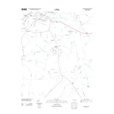
2013 Map of Rivermont
USGS Topo · Published 2013About this map
The Neuse River basin south of Kinston is defined by a dense network of watercourses and agricultural crossroads in the early 21st century. The landscape is punctuated by numerous named branches and swamps, including Vine Swamp, Mott Swamp, and Southwest Cr, which shape the rural settlement patterns. Near the northern bend of the river, established communities such as Rivermont, Dupreeville, and Meadow Brook cluster along the highway corridors, while the Lenoir County Fairgrounds serves as a prominent local landmark just south of Mary Beth Park.
Find a feature on this map
125 named features on this map. Tap any name to fly to it.
Don’t see what you’re looking for? This feature index may not catch every label — zoom into the map to look around manually.
Map Details
Editions of this 2013 Rivermont Map
This is the sole edition of this map. No revisions or reprints were ever made.
Other maps of this area

1902 · Ayden
USGS Topo · 1:62,500

1903 · Trent River
USGS Topo · 1:62,500

1904 · Ayden
USGS Topo · 1:62,500

1904 · Trent River
USGS Topo · 1:62,500

1914 · Kinston
USGS Topo · 1:48,000

1916 · Kinston
USGS Topo · 1:62,500

1953 · Rocky Mount
USGS Topo · 1:250,000

1954 · Rocky Mount
USGS Topo · 1:250,000

1958 · Deep Run
USGS Topo · 1:62,500
1980 · Pink Hill
USGS Topo · 1:24,000