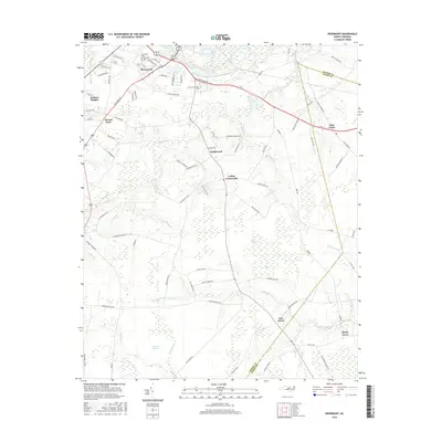
2016 Map of Rivermont
USGS Topo · Published 2016About this map
Lenoir Community Coll serves as a central landmark just southeast of the developing Rivermont community, where the Southview Cem and Southwest Cem provide vital records for local family histories. The landscape is defined by its low-lying wetlands, notably the Ball Pocosin and Bearwell Pocosin, which are drained by a complex network of creeks and swamps including Vine Swamp and Southwest Cr. Historical crossroads and small settlements like Loftins Crossroads, Wise Forks, and Parrott Fork mark the intersections of rural routes like Richlands Rd and Woodington Rd. The map illustrates the persistent agricultural and rural residential character of this part of Lenoir and Jones Counties, where long-established names such as Elm Grove and Shady Grove anchor the community identity south of the Neuse River.
Find a feature on this map
88 named features on this map. Tap any name to fly to it.
Don’t see what you’re looking for? This feature index may not catch every label — zoom into the map to look around manually.
Map Details
Editions of this 2016 Rivermont Map
This is the sole edition of this map. No revisions or reprints were ever made.
Other maps of this area

1902 · Ayden
USGS Topo · 1:62,500

1903 · Trent River
USGS Topo · 1:62,500

1904 · Ayden
USGS Topo · 1:62,500

1904 · Trent River
USGS Topo · 1:62,500

1914 · Kinston
USGS Topo · 1:48,000

1916 · Kinston
USGS Topo · 1:62,500

1953 · Rocky Mount
USGS Topo · 1:250,000

1954 · Rocky Mount
USGS Topo · 1:250,000

1958 · Deep Run
USGS Topo · 1:62,500
1980 · Pink Hill
USGS Topo · 1:24,000