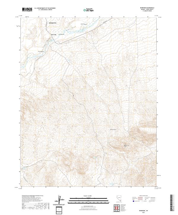
2021 Map of Riverside
USGS Topo · Published 2021About this map
The Virgin River carves a critical corridor through this arid corner of the Mojave Desert, supporting a series of low-lying areas known as Latham Bottom, Cook Bottom, and Arnold Bottom. The small settlement of Riverside serves as a focal point near the river's bend, while the southern edge of Mesquite is visible to the north. This 2021 survey illustrates the precarious reliance on water in the region, tracing the Virgin Valley floor against the rising elevation of Bunkerville Ridge. Away from the primary riverbed, the landscape is defined by seasonal drainages like Nickel Cr and isolated water sources such as Government Spring, Juanita Springs, and North Key West Spring, which have long been vital for travel and ranching in this part of Clark County.
Find a feature on this map
20 named features on this map. Tap any name to fly to it.
Don’t see what you’re looking for? This feature index may not catch every label — zoom into the map to look around manually.
Map Details
Editions of this 2021 Riverside Map
This is the sole edition of this map. No revisions or reprints were ever made.
Other maps of this area

1886 · Saint Thomas
USGS Topo · 1:250,000

1893 · Saint Thomas
USGS Topo · 1:250,000

1954 · Las Vegas
USGS Topo · 1:250,000

1957 · Las Vegas
USGS Topo · 1:250,000

1957 · Mesquite
USGS Topo · 1:62,500

1958 · Virgin Peak
USGS Topo · 1:62,500

1958 · Overton
USGS Topo · 1:62,500

1959 · Las Vegas
USGS Topo · 1:250,000

1962 · Las Vegas
USGS Topo · 1:250,000
1969 · Moapa Peak SE
USGS Topo · 1:24,000