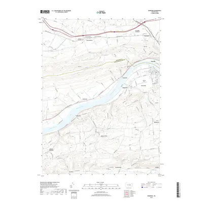
2019 Map of Riverside
USGS Topo · Published 2019About this map
The Susquehanna River bisects this landscape, serving as a primary corridor for the communities of Riverside and Danville. The river's influence on local development is evident in the cluster of infrastructure along its banks, including the Danville Airport and several riverfront settlements like Chulasky and Cameron. Further north, the legacy of early local industry is preserved in the label for Franklin Furnace, situated near Mausdale.
Find a feature on this map
41 named features on this map. Tap any name to fly to it.
Don’t see what you’re looking for? This feature index may not catch every label — zoom into the map to look around manually.
Map Details
Editions of this 2019 Riverside Map
This is the sole edition of this map. No revisions or reprints were ever made.
Other maps of this area

1892 · Shamokin
USGS Topo · 1:62,500

1893 · Sunbury
USGS Topo · 1:62,500

1893 · Shamokin
USGS Topo · 1:62,500

1924 · Milton
USGS Topo · 1:62,500

1935 · Hughesville
USGS Topo · 1:62,500

1943 · Shamokin
USGS Topo · 1:62,500

1943 · Sunbury
USGS Topo · 1:62,500

1950 · Harrisburg
USGS Topo · 1:250,000

1952 · Shamokin
USGS Topo · 1:62,500

1953 · Hughesville
USGS Topo · 1:62,500