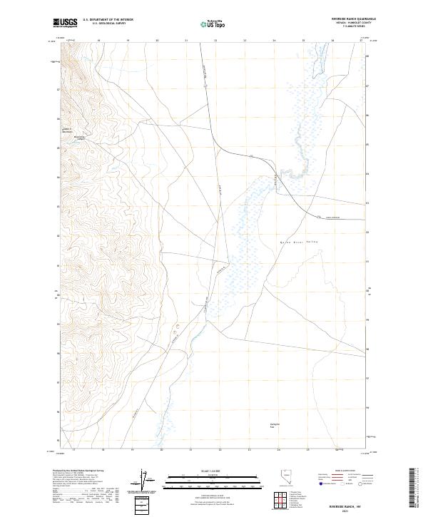
2021 Map of Riverside Ranch
USGS Topo · Published 2021About this map
Pretty Cr and Dry Cr carve through the arid high-desert landscape of Humboldt County, defining the drainage patterns of this remote Nevada corner. The terrain is marked by the presence of Hoppin Spring, a critical water source in a region where reliable moisture is scarce. These features reflect the stark hydrology of the Great Basin, where seasonal creeks and isolated springs dictated the routes of early travelers and the placement of remote ranching operations. The mapping of these small watercourses and springs provides essential data for understanding the historical and ecological connectivity of the Quinn River Valley basin.
Find a feature on this map
3 named features on this map. Tap any name to fly to it.
Don’t see what you’re looking for? This feature index may not catch every label — zoom into the map to look around manually.
Map Details
Editions of this 2021 Riverside Ranch Map
This is the sole edition of this map. No revisions or reprints were ever made.
Other maps of this area

1882 · Paradise
USGS Topo · 1:250,000

1886 · Disaster
USGS Topo · 1:250,000

1893 · Paradise
USGS Topo · 1:250,000

1893 · Disaster
USGS Topo · 1:250,000

1954 · Vya
USGS Topo · 1:250,000

1955 · McDermitt
USGS Topo · 1:250,000

1958 · Vya
USGS Topo · 1:250,000

1958 · Awakening Peak
USGS Topo · 1:62,500

1959 · McDermitt
USGS Topo · 1:250,000

1959 · Orovada
USGS Topo · 1:62,500