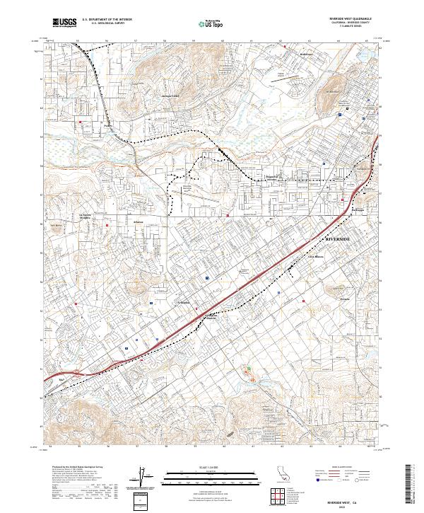
2022 Map of Riverside West
USGS Topo · Published 2022About this map
The Santa Ana River carves a central path through this southern California landscape, separating the rugged heights of Mt Rubidoux from the expanding neighborhoods of Jurupa Valley and Rubidoux. This record of the modern city layout captures the intricate network of water management essential to the region, including the Gage Canal, Riverside Canal, and the Arlington Valley Channel. To the south, the terrain transitions into the more open spaces of Mockingbird Canyon and the Mockingbird Reservoir, while the urban core is anchored by institutional landmarks such as Riverside City College and the Riverside County Historic Courthouse.
Find a feature on this map
48 named features on this map. Tap any name to fly to it.
Don’t see what you’re looking for? This feature index may not catch every label — zoom into the map to look around manually.
Map Details
Editions of this 2022 Riverside West Map
This is the sole edition of this map. No revisions or reprints were ever made.
Other maps of this area

1896 · San Bernardino
USGS Topo · 1:62,500

1897 · Cucamonga
USGS Topo · 1:62,500

1898 · San Bernardino
USGS Topo · 1:62,500

1900 · Cucamonga
USGS Topo · 1:62,500

1901 · Southern California Sheet No. 1
USGS Topo · 1:250,000

1901 · San Bernardino
USGS Topo · 1:62,500

1901 · Elsinore
USGS Topo · 1:125,000

1901 · Riverside
USGS Topo · 1:62,500

1902 · Corona
USGS Topo · 1:125,000

1903 · Cucamonga
USGS Topo · 1:62,500