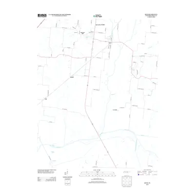
2013 Map of Rives
USGS Topo · Published 2013About this map
Rives serves as the primary hub in this West Tennessee landscape, where the confluence of regional roads and the winding Cypress Cr define the local geography. The map reveals a pattern of rural settlements and agricultural estates north of the Obion River, including McCutchen Heights, Pleasant Hill, and Moffatt. These communities are connected by a network of family-named routes such as Ed Moffatt Rd and K Harper Rd, suggesting deep generational ties to the land.
Find a feature on this map
69 named features on this map. Tap any name to fly to it.
Don’t see what you’re looking for? This feature index may not catch every label — zoom into the map to look around manually.
Map Details
Editions of this 2013 Rives Map
This is the sole edition of this map. No revisions or reprints were ever made.
Other maps of this area

1950 · Obion
USGS Topo · 1:24,000

1950 · Rives
USGS Topo · 1:24,000

1951 · Obion
USGS Topo · 1:24,000

1951 · Rives
USGS Topo · 1:24,000

1954 · Rutherford
USGS Topo · 1:24,000

1954 · Union City
USGS Topo · 1:24,000

1956 · Gardner
USGS Topo · 1:24,000

1956 · Harris
USGS Topo · 1:24,000

1956 · Dyersburg
USGS Topo · 1:250,000
1965 · Kenton
USGS Topo · 1:24,000