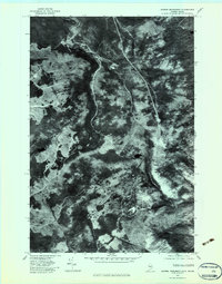
1977 Map of Riviere Monument
USGS Topo · Published 1983About this map
Riviere Liniere flows through this remote stretch of the international border between Quebec and Maine, as documented by aerial photography from the late 1970s. This orthophotograph provides a clear visual record of the timbered landscape and logging access roads that define the region. In the southern portion of the sheet, the high ground of Sandy Bay Mountain overlooks the drainage of the S Br Penobscot R. The map centers on the border itself, marked by the label Monument, where the small Lac du Monument sits directly on the dividing line. For those researching the history of the North Woods or border surveying, this map offers a precise view of the terrain before more modern developments, showing the dense forest canopy and the naturally winding watercourses that have historically guided surveyors and trappers through this isolated territory.
Find a feature on this map
5 named features on this map. Tap any name to fly to it.
Don’t see what you’re looking for? This feature index may not catch every label — zoom into the map to look around manually.
Map Details
Editions of this 1977 Riviere Monument Map
This is the sole edition of this map. No revisions or reprints were ever made.
Other maps of this area

1923 · Attean
USGS Topo · 1:62,500

1925 · Attean
USGS Topo · 1:62,500

1927 · Sandy Bay
USGS Topo · 1:48,000

1928 · Skinner
USGS Topo · 1:48,000

1930 · Sandy Bay
USGS Topo · 1:62,500

1931 · Skinner
USGS Topo · 1:62,500

1944 · Sandy Bay
USGS Topo · 1:62,500

1949 · Jackman
USGS Topo · 1:250,000

1950 · Attean
USGS Topo · 1:50,000

1963 · Jackman
USGS Topo · 1:250,000