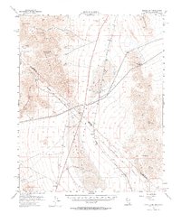
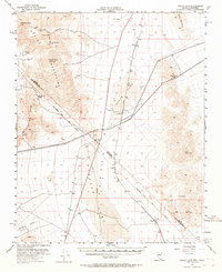
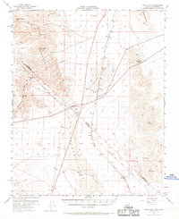
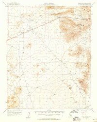
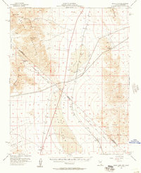
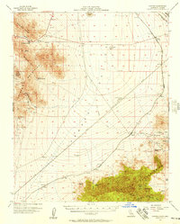
1955 Map of Roach Lake
USGS Topo · Published 1969About this map
Spring Mountains peaks and the dry basins of the Mojave Desert dominate this mid-century survey of the Nevada-California border. The Union Pacific railroad tracks provide the primary corridor for human activity, connecting small sidings and outposts like Roach, Borax, and Calada across the arid landscape. The geography is defined by the massive dry beds of Roach Lake and Ivanpah Lake, which serve as stark markers between the mountain ranges.
Find a feature on this map
30 named features on this map. Tap any name to fly to it.
Don’t see what you’re looking for? This feature index may not catch every label — zoom into the map to look around manually.
Map Details
Editions of this 1955 Roach Lake Map
4 editions found
Other maps of this area

1910 · Ivanpah
USGS Topo · 1:250,000

1912 · Ivanpah
USGS Topo · 1:250,000

1942 · Ivanpah
USGS Topo · 1:250,000

1947 · Kingman
USGS Topo · 1:250,000

1948 · Kingman
USGS Topo · 1:250,000

1954 · Kingman
USGS Topo · 1:250,000

1955 · Kingman
USGS Topo · 1:250,000
1955 · Mescal Range
USGS Topo · 1:62,500
1955 · Roach Lake
USGS Topo · 1:62,500
1956 · Ivanpah
USGS Topo · 1:62,500