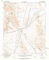
1955 Map of Roach Lake
USGS Topo · Published 1964About this map
The dry basin of Roach Lake dominates this mid-century survey of the high desert borderlands between Clark County, Nevada, and San Bernardino County, California. This arid landscape is defined by the heavy infrastructure of the Union Pacific railroad, which supported a string of isolated desert outposts including Roach, Calada, and Borax. Historically significant boundary markers are prominent, most notably the Von Schmidt Line, representing an early attempt to survey the state line.
Find a feature on this map
28 named features on this map. Tap any name to fly to it.
Don’t see what you’re looking for? This feature index may not catch every label — zoom into the map to look around manually.
Map Details
Editions of this 1955 Roach Lake Map
4 editions found
Other maps of this area

1910 · Ivanpah
USGS Topo · 1:250,000

1912 · Ivanpah
USGS Topo · 1:250,000

1942 · Ivanpah
USGS Topo · 1:250,000

1947 · Kingman
USGS Topo · 1:250,000

1948 · Kingman
USGS Topo · 1:250,000

1954 · Kingman
USGS Topo · 1:250,000

1955 · Kingman
USGS Topo · 1:250,000

1955 · Mescal Range
USGS Topo · 1:62,500

1955 · Roach Lake
USGS Topo · 1:62,500

1956 · Ivanpah
USGS Topo · 1:62,500