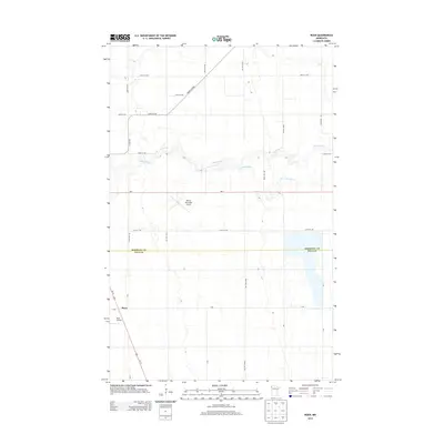
2013 Map of Roan
USGS Topo · Published 2013About this map
Roan sits at the intersection of Us-75 and several rural townships in this early 21st-century landscape along the border of Marshall and Polk Counties. The area's agricultural identity is clearly defined by a rigid section-line road network, including 210th St NW and 300th Ave NW, which carve through the Red River Valley. Aviation infrastructure is a notable component of the local economy and transport, represented by both the Warren Municipal Airport and the smaller Roan Airport to the south. The natural topography is shaped by the meandering course of the Snake River and its S Br Snake River, which provide the primary relief in an otherwise flat, productive prairie. Transport history is further detailed by the Great Eastern rail corridor and state highway Mn-1, which bisect the northern portion of the quadrangle.
Find a feature on this map
28 named features on this map. Tap any name to fly to it.
Don’t see what you’re looking for? This feature index may not catch every label — zoom into the map to look around manually.
Map Details
Editions of this 2013 Roan Map
This is the sole edition of this map. No revisions or reprints were ever made.
Other maps of this area

1918 · Angus
USGS Topo · 1:62,500

1918 · Argyle
USGS Topo · 1:62,500

1918 · Warren
USGS Topo · 1:62,500

1952 · Thief River Falls
USGS Topo · 1:250,000

1954 · Stephen
USGS Topo · 1:62,500

1955 · Warren
USGS Topo · 1:62,500

1956 · Thief River Falls
USGS Topo · 1:250,000

1956 · Florian
USGS Topo · 1:62,500

1957 · Thief River Falls
USGS Topo · 1:250,000

1961 · Radium
USGS Topo · 1:24,000