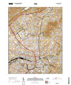
2019 Map of Roanoke
USGS Topo · Published 2019About this map
Roanoke and the neighboring community of Vinton occupy the valley floor between the prominent ridges of Tinker Mtn and Mill Mtn. The 2019 landscape reveals a dense network of infrastructure centered on the Norfolk and Western Ry and the Roanoke-Blacksburg Regional Airport/Woodrum Field. This modern survey highlights the civic heart of the area, including the Roanoke City Courthouse and Roanoke City Hall, while preserving numerous legacy landmarks essential for local history. Several historic burial sites, such as Old Lick Cem and the Jonathan Tosh Cem, are documented alongside major educational institutions like Hollins University. The topographic data captures the complex drainage of the Roanoke River and its tributaries like Lick Run and Tinker Creek as they wind through the urban and suburban sprawl of Hollins and Riverdale.
Find a feature on this map
436 named features on this map. Tap any name to fly to it.
Don’t see what you’re looking for? This feature index may not catch every label — zoom into the map to look around manually.
Map Details
Editions of this 2019 Roanoke Map
This is the sole edition of this map. No revisions or reprints were ever made.
Other maps of this area

1890 · Roanoke
USGS Topo · 1:125,000

1890 · Christiansburg
USGS Topo · 1:125,000

1891 · Roanoke
USGS Topo · 1:125,000

1929 · Roanoke
USGS Topo · 1:48,000

1929 · Salem
USGS Topo · 1:48,000

1932 · Salem
USGS Topo · 1:62,500

1933 · Roanoke
USGS Topo · 1:62,500

1947 · Roanoke
USGS Topo · 1:250,000

1950 · Elliston
USGS Topo · 1:62,500

1951 · Boones Mill
USGS Topo · 1:62,500