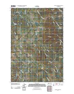
2011 Map of Roaring Creek
USGS Topo · Published 2011About this map
Roaring Creek and the headwaters of the Tualatin River system define this forested landscape in the Coast Range foothills during the early 21st century. The map reveals a complex network of timber and access roads, including the Stimson Mainline Rd and Old Railroad Grade Rd, which trace the legacy of industrial logging and former rail corridors through the steep drainages. High points like South Saddle Mountain and the elongated Baseline Ridge divide numerous active watersheds.
Find a feature on this map
38 named features on this map. Tap any name to fly to it.
Don’t see what you’re looking for? This feature index may not catch every label — zoom into the map to look around manually.
Map Details
Editions of this 2011 Roaring Creek Map
This is the sole edition of this map. No revisions or reprints were ever made.
Other maps of this area

1941 · Timber
USGS Topo · 1:62,500

1941 · Gales Creek
USGS Topo · 1:62,500

1941 · Yamhill
USGS Topo · 1:62,500

1942 · Yamhill
USGS Topo · 1:62,500

1942 · Fairdale
USGS Topo · 1:62,500

1948 · Vancouver
USGS Topo · 1:250,000

1950 · Vancouver
USGS Topo · 1:250,000

1950 · Vancouver
USGS Topo · 1:250,000

1955 · Timber
USGS Topo · 1:62,500

1955 · Fairdale
USGS Topo · 1:62,500