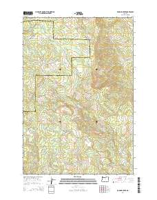
2014 Map of Roaring Creek
USGS Topo · Published 2014About this map
Saddle Mountain and the surrounding timberlands define this section of the Oregon Coast Range, where the drainage systems of the Tualatin and Wilson Rivers meet. The landscape is characterized by a dense network of forestry and access roads, including Firebreak One Rd, Stimson Mainline Rd, and Saddlemountain Rd. These routes crisscross the steep terrain, providing access to remote valleys carved by the Devils Lake Fork and Scoggins Cr.
Find a feature on this map
42 named features on this map. Tap any name to fly to it.
Don’t see what you’re looking for? This feature index may not catch every label — zoom into the map to look around manually.
Map Details
Editions of this 2014 Roaring Creek Map
This is the sole edition of this map. No revisions or reprints were ever made.
Other maps of this area

1941 · Timber
USGS Topo · 1:62,500

1941 · Gales Creek
USGS Topo · 1:62,500

1941 · Yamhill
USGS Topo · 1:62,500

1942 · Yamhill
USGS Topo · 1:62,500

1942 · Fairdale
USGS Topo · 1:62,500

1948 · Vancouver
USGS Topo · 1:250,000

1950 · Vancouver
USGS Topo · 1:250,000

1950 · Vancouver
USGS Topo · 1:250,000

1955 · Timber
USGS Topo · 1:62,500

1955 · Fairdale
USGS Topo · 1:62,500