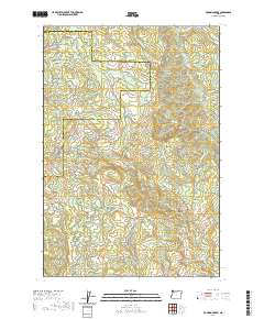
2020 Map of Roaring Creek
USGS Topo · Published 2020About this map
The high peaks of Saddle Mtn and South Saddle Mtn dominate this portion of the Northern Oregon Coast Range along the border of Tillamook and Washington Counties. This area is defined by its complex network of forestry roads and historic routes, including the Wilson River Wagon Road Trail and the Nels Rogers Trail. The drainage patterns are intricate, with headwaters for Roaring Creek, Devils Lake Fork, and South Fork Gales Creek carving through the steep topography. An Old Railroad Grade Road in the southern portion of the map suggests the legacy of early 20th-century logging infrastructure that once penetrated these deep valleys. Notable landmarks like Skunk Hollow and Baseline Ridge provide further orientation for those tracing the geographic history of this timber-rich region.
Find a feature on this map
49 named features on this map. Tap any name to fly to it.
Don’t see what you’re looking for? This feature index may not catch every label — zoom into the map to look around manually.
Map Details
Editions of this 2020 Roaring Creek Map
This is the sole edition of this map. No revisions or reprints were ever made.
Other maps of this area

1941 · Timber
USGS Topo · 1:62,500

1941 · Gales Creek
USGS Topo · 1:62,500

1941 · Yamhill
USGS Topo · 1:62,500

1942 · Yamhill
USGS Topo · 1:62,500

1942 · Fairdale
USGS Topo · 1:62,500

1948 · Vancouver
USGS Topo · 1:250,000

1950 · Vancouver
USGS Topo · 1:250,000

1950 · Vancouver
USGS Topo · 1:250,000

1955 · Timber
USGS Topo · 1:62,500

1955 · Fairdale
USGS Topo · 1:62,500