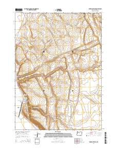
2014 Map of Roaring Springs
USGS Topo · Published 2014About this map
Roaring Springs and the surrounding ranching landscape define this portion of Harney County, where the high desert terrain transitions into deep basalt-walled formations. The Catlow Rim stands as a prominent geological boundary, overlooking the broad expanse of Catlow Valley and providing a backdrop for the Roaring Springs Ranch Airport. This area is characterized by seasonal watercourses like Roaring Springs Cr and Dry Cr, which have carved intricate drainage systems such as Roaring Springs Canyon and Kueny Canyon over millennia.
Find a feature on this map
21 named features on this map. Tap any name to fly to it.
Don’t see what you’re looking for? This feature index may not catch every label — zoom into the map to look around manually.
Map Details
Editions of this 2014 Roaring Springs Map
This is the sole edition of this map. No revisions or reprints were ever made.
Other maps of this area

1955 · Adel
USGS Topo · 1:250,000

1957 · Adel
USGS Topo · 1:250,000

1958 · Adel
USGS Topo · 1:250,000

1962 · Adel
USGS Topo · 1:250,000

1967 · Roaring Springs
USGS Topo · 1:24,000

1967 · Frenchglen
USGS Topo · 1:24,000

1967 · Page Springs
USGS Topo · 1:24,000

1968 · Tombstone Canyon
USGS Topo · 1:24,000

1968 · Roaring Springs SE
USGS Topo · 1:24,000

1971 · Blitzen
USGS Topo · 1:24,000