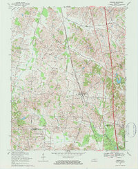
1969 Map of Robards
USGS Topo · Published 1984About this map
Robards serves as the primary hub in this West Kentucky landscape, where the Louisville and Nashville railroad tracks and the modern Pennyrile Parkway parallel one another through the rolling terrain. The map reveals an intensive petroleum economy, with clusters of Oil Wells scattered across the countryside, particularly west of the rail line. This industrial presence is woven into a traditional rural fabric defined by family-named landmarks and small community centers.
Find a feature on this map
37 named features on this map. Tap any name to fly to it.
Don’t see what you’re looking for? This feature index may not catch every label — zoom into the map to look around manually.
Map Details
Editions of this 1969 Robards Map
2 editions found
Other maps of this area

1905 · Newburg
USGS Topo · 1:62,500

1906 · Sebree
USGS Topo · 1:62,500

1908 · Calhoun
USGS Topo · 1:62,500

1914 · Henderson
USGS Topo · 1:48,000

1916 · Henderson
USGS Topo · 1:62,500

1949 · Sebree
USGS Topo · 1:24,000

1949 · Poole
USGS Topo · 1:24,000

1949 · Robards
USGS Topo · 1:24,000

1951 · Dixon
USGS Topo · 1:24,000

1951 · Poole
USGS Topo · 1:24,000