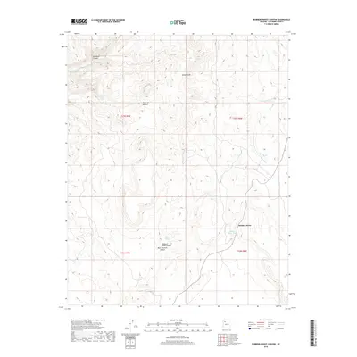
2018 Map of Robbers Roost Canyon
USGS Topo · Published 2018About this map
Tower of Babylon and the Aubrey Cliffs dominate this Coconino County landscape, where the high plateaus are cut by deep drainage systems like Diamond Canyon and Robbers Roost Canyon. The region's reliance on scarce water sources is evident in the strategic distribution of livestock tanks and natural seeps, including Beecher Tank, Starkweather Tank, and Wilder Springs.
Find a feature on this map
18 named features on this map. Tap any name to fly to it.
Don’t see what you’re looking for? This feature index may not catch every label — zoom into the map to look around manually.
Map Details
Editions of this 2018 Robbers Roost Canyon Map
This is the sole edition of this map. No revisions or reprints were ever made.
Other maps of this area

1886 · Diamond Creek
USGS Topo · 1:250,000

1892 · Diamond Creek
USGS Topo · 1:250,000

1948 · Williams
USGS Topo · 1:250,000

1954 · Williams
USGS Topo · 1:250,000

1956 · Williams
USGS Topo · 1:250,000

1960 · Williams
USGS Topo · 1:250,000

1961 · Williams
USGS Topo · 1:250,000
1967 · Frazier Wells
USGS Topo · 1:24,000
1967 · Peach Springs NE
USGS Topo · 1:24,000
1967 · Diamond Peak
USGS Topo · 1:24,000