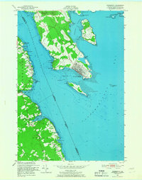
1949 Map of Robbinston
USGS Topo · Published 1966About this map
St Andrews occupies the prominent peninsula between Passamaquoddy Bay and the St Croix River in this mid-century survey of the Maine-New Brunswick border. The international boundary splits the river and bay, separating the Canadian rail terminus of the Canadian Pacific and the Biological Station from the American settlements of Robbinston and North Perry. On the Maine shore, the map reveals a landscape of rural infrastructure including the U S Customs office, the Brewer Cem, and the Shore Sch near Loring Cove.
Find a feature on this map
51 named features on this map. Tap any name to fly to it.
Don’t see what you’re looking for? This feature index may not catch every label — zoom into the map to look around manually.
Map Details
Editions of this 1949 Robbinston Map
3 editions found
Other maps of this area

1907 · Eastport
USGS Topo · 1:48,000

1908 · Eastport
USGS Topo · 1:62,500

1929 · Robbinston
USGS Topo · 1:48,000

1931 · Robbinston
USGS Topo · 1:62,500

1943 · Eastport
USGS Topo · 1:62,500

1945 · Eastport
USGS Topo · 1:62,500

1949 · Robbinston
USGS Topo · 1:24,000

1949 · Pembroke
USGS Topo · 1:24,000

1949 · Red Beach
USGS Topo · 1:24,000

1949 · Devils Head
USGS Topo · 1:24,000