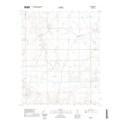
2021 Map of Robbs
USGS Topo · Published 2021About this map
Robbs and Buckhorn anchor a landscape defined by the intersection of three Mississippi counties: Calhoun, Pontotoc, and Chickasaw. This modern survey illustrates the enduring rural layout of north-central Mississippi, where small communities like Matthews and Reid are connected by a network of county roads including Co RD 155 and Rocky Mount Rd. The drainage patterns are a primary feature, with the Skuna River and Old River Run flowing through the southern portion of the quadrangle, while numerous creeks like Kittahutty Cr and Buckhorn Cr carve the terrain. For genealogists and local historians, the map provides precise locations for several family and community burial grounds, such as Blount Cem, Hunters Cem, and Rocky Mount Cem, which serve as vital markers of the region's long-term settlement history.
Find a feature on this map
68 named features on this map. Tap any name to fly to it.
Don’t see what you’re looking for? This feature index may not catch every label — zoom into the map to look around manually.
Map Details
Editions of this 2021 Robbs Map
This is the sole edition of this map. No revisions or reprints were ever made.
Other maps of this area

1953 · West Point
USGS Topo · 1:250,000

1954 · Pittsboro
USGS Topo · 1:62,500

1956 · Tupelo
USGS Topo · 1:250,000

1958 · Tupelo
USGS Topo · 1:250,000

1958 · West Point
USGS Topo · 1:250,000

1963 · West Point
USGS Topo · 1:250,000

1972 · Houlka
USGS Topo · 1:24,000

1972 · Robbs
USGS Topo · 1:24,000

1972 · Vardaman
USGS Topo · 1:24,000

1972 · Randolph
USGS Topo · 1:24,000