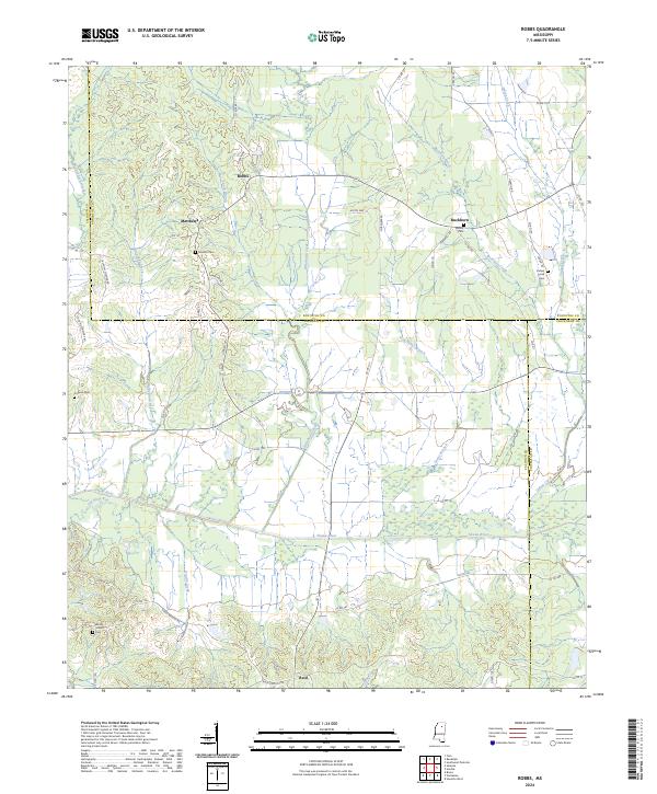
2024 Map of Robbs
USGS Topo · Published 2024About this map
Skuna River bottomlands dominate this section of the North Mississippi hill country, where the borders of Calhoun, Pontotoc, and Chickasaw counties meet. Small rural settlements like Robbs, Matthews, and Buckhorn are connected by a network of winding county roads, including Robbs Bend and Hebron Rd. The map reveals a deeply rooted local history through its numerous family and community burial grounds, such as Hunters Cem, Indian Creek Cem, and Rocky Mount Cem. The landscape is defined by its drainage systems, with Buckhorn Creek and Kittahutty Creek flowing through the timbered terrain toward the larger river basin. To the south, the community of Reid sits near the confluence of several small branches, illustrating the traditional settlement patterns of the region's agricultural past.
Find a feature on this map
66 named features on this map. Tap any name to fly to it.
Don’t see what you’re looking for? This feature index may not catch every label — zoom into the map to look around manually.
Map Details
Editions of this 2024 Robbs Map
This is the sole edition of this map. No revisions or reprints were ever made.
Other maps of this area

1953 · West Point
USGS Topo · 1:250,000

1954 · Pittsboro
USGS Topo · 1:62,500

1956 · Tupelo
USGS Topo · 1:250,000

1958 · Tupelo
USGS Topo · 1:250,000

1958 · West Point
USGS Topo · 1:250,000

1963 · West Point
USGS Topo · 1:250,000

1972 · Houlka
USGS Topo · 1:24,000

1972 · Robbs
USGS Topo · 1:24,000

1972 · Vardaman
USGS Topo · 1:24,000

1972 · Randolph
USGS Topo · 1:24,000