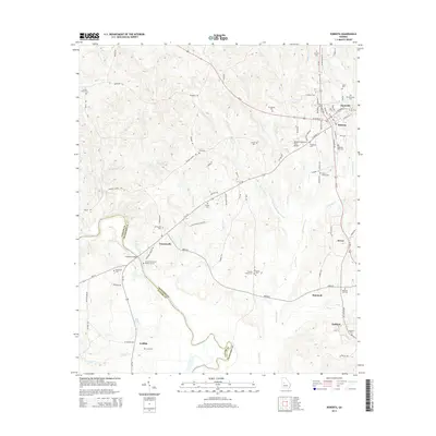
2014 Map of Roberta
USGS Topo · Published 2014About this map
Roberta and Knoxville anchor the northeastern portion of this Crawford County landscape, where the local economy transitions from the developed Roberta-Industrial Park-Airport to the expansive rural acreage bordering the Flint River. This waterway forms a primary natural boundary in the southwest, crossing at Hawkins Bridge near the Hawkins Grave of Colonel Benjamin Hawkins. The terrain is defined by a dense network of creek systems, including Culpepper Creek, Avery Creek, and Big Branch Lewis Creek, which have shaped the settlement patterns of outlying communities like Francisville, Hammett, and Gaillard.
Find a feature on this map
102 named features on this map. Tap any name to fly to it.
Don’t see what you’re looking for? This feature index may not catch every label — zoom into the map to look around manually.
Map Details
Editions of this 2014 Roberta Map
This is the sole edition of this map. No revisions or reprints were ever made.
Other maps of this area

1951 · Yatesville
USGS Topo · 1:62,500

1955 · Phenix City
USGS Topo · 1:250,000

1956 · Fort Valley
USGS Topo · 1:62,500

1956 · Bolingbroke
USGS Topo · 1:62,500

1957 · Phenix City
USGS Topo · 1:250,000

1957 · Macon
USGS Topo · 1:250,000

1958 · Macon
USGS Topo · 1:250,000

1958 · Phenix City
USGS Topo · 1:250,000

1964 · Macon
USGS Topo · 1:250,000

1971 · Fickling Mill
USGS Topo · 1:24,000