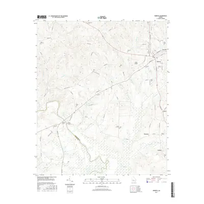
2017 Map of Roberta
USGS Topo · Published 2017About this map
Knoxville and the neighboring community of Roberta serve as the primary hubs in this central Georgia landscape, where the Flint River marks the western boundary against Taylor County. The area is dense with family and community history, evidenced by a high concentration of burial sites such as the Old Knoxville Cem, Confederate Cem, and the Jordan Grove Cem. A significant historical landmark is found near the river: the Colonel Benjamin Hawkins Grave and the nearby Hawkins Bridge, honoring the 18th-century Indian Agent who established his homestead in this vicinity.
Find a feature on this map
83 named features on this map. Tap any name to fly to it.
Don’t see what you’re looking for? This feature index may not catch every label — zoom into the map to look around manually.
Map Details
Editions of this 2017 Roberta Map
This is the sole edition of this map. No revisions or reprints were ever made.
Other maps of this area

1951 · Yatesville
USGS Topo · 1:62,500

1955 · Phenix City
USGS Topo · 1:250,000

1956 · Fort Valley
USGS Topo · 1:62,500

1956 · Bolingbroke
USGS Topo · 1:62,500

1957 · Phenix City
USGS Topo · 1:250,000

1957 · Macon
USGS Topo · 1:250,000

1958 · Macon
USGS Topo · 1:250,000

1958 · Phenix City
USGS Topo · 1:250,000

1964 · Macon
USGS Topo · 1:250,000

1971 · Fickling Mill
USGS Topo · 1:24,000