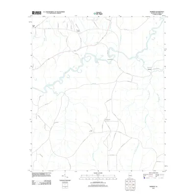
2011 Map of Roberts
USGS Topo · Published 2011About this map
The Conecuh River snakes through the heart of this Escambia County landscape, defined by a network of winding local roads and small rural communities. The small settlement of Roberts sits near the eastern edge of the survey, while Rock Hill is situated in the northwest. This area of Alabama is heavily drained by numerous tributaries, including Bethea Mill Creek and Yellow Water Creek, which carve through the terrain between family-named roads like Jack Byrd Rd and Dawkins Rd.
Find a feature on this map
54 named features on this map. Tap any name to fly to it.
Don’t see what you’re looking for? This feature index may not catch every label — zoom into the map to look around manually.
Map Details
Editions of this 2011 Roberts Map
This is the sole edition of this map. No revisions or reprints were ever made.
Other maps of this area

1943 · Jay
USGS Topo · 1:62,500

1948 · Munson
USGS Topo · 1:62,500

1950 · Munson
USGS Topo · 1:62,500

1953 · Andalusia
USGS Topo · 1:250,000

1957 · Andalusia
USGS Topo · 1:250,000

1957 · Pensacola
USGS Topo · 1:250,000

1959 · Pensacola
USGS Topo · 1:250,000

1959 · Brewton South
USGS Topo · 1:24,000

1960 · Pensacola
USGS Topo · 1:250,000

1960 · Brewton South
USGS Topo · 1:24,000