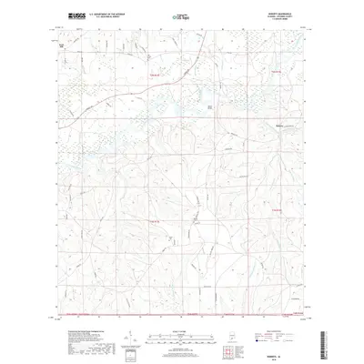
2018 Map of Roberts
USGS Topo · Published 2018About this map
The Conecuh River winds through the heart of this Escambia County landscape, carving a broad valley punctuated by numerous oxbows and wetlands. Near Parker Bridge, the river's path is flanked by a dense network of timber-access roads like Forrest Ave and Bradley Rd, reflecting the region's enduring forestry character. The settlement of Roberts sits near the confluence of West-Prong Silas Creek and East-Prong Silas Creek, while the community of Rock Hill occupies the northwestern heights above the river bottomlands.
Find a feature on this map
65 named features on this map. Tap any name to fly to it.
Don’t see what you’re looking for? This feature index may not catch every label — zoom into the map to look around manually.
Map Details
Editions of this 2018 Roberts Map
This is the sole edition of this map. No revisions or reprints were ever made.
Other maps of this area

1943 · Jay
USGS Topo · 1:62,500

1948 · Munson
USGS Topo · 1:62,500

1950 · Munson
USGS Topo · 1:62,500

1953 · Andalusia
USGS Topo · 1:250,000

1957 · Andalusia
USGS Topo · 1:250,000

1957 · Pensacola
USGS Topo · 1:250,000

1959 · Pensacola
USGS Topo · 1:250,000

1959 · Brewton South
USGS Topo · 1:24,000

1960 · Pensacola
USGS Topo · 1:250,000

1960 · Brewton South
USGS Topo · 1:24,000