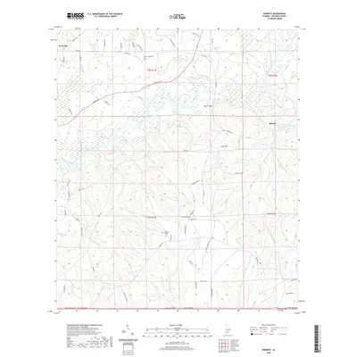
2020 Map of Roberts
USGS Topo · Published 2020About this map
Conecuh River meanders through the heart of this Escambia County landscape, shaping a terrain defined by its complex network of tributaries and local history. Near the western edge, the settlement of Rock Hill anchors the upland territory, while Roberts lies to the east, connected by a web of rural roads such as Ridge Rd and Forrest Ave. The map provides a detailed view of family and community life through its well-documented burial grounds, including May Creek Cem in the north and the Fuqua Haveard Cem near the center. The crossing at Parker Bridge serves as a critical junction over the river, linking these rural outposts. To the south, the headwaters of E Fork Big Coldwater Cr and Yellow Water Cr signal the beginning of significant drainage basins that define the local geography.
Find a feature on this map
63 named features on this map. Tap any name to fly to it.
Don’t see what you’re looking for? This feature index may not catch every label — zoom into the map to look around manually.
Map Details
Editions of this 2020 Roberts Map
This is the sole edition of this map. No revisions or reprints were ever made.
Other maps of this area

1943 · Jay
USGS Topo · 1:62,500

1948 · Munson
USGS Topo · 1:62,500

1950 · Munson
USGS Topo · 1:62,500

1953 · Andalusia
USGS Topo · 1:250,000

1957 · Andalusia
USGS Topo · 1:250,000

1957 · Pensacola
USGS Topo · 1:250,000

1959 · Pensacola
USGS Topo · 1:250,000

1959 · Brewton South
USGS Topo · 1:24,000

1960 · Pensacola
USGS Topo · 1:250,000

1960 · Brewton South
USGS Topo · 1:24,000