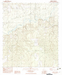
1982 Map of Roberts
USGS Topo · Published 1982About this map
The Conecuh River defines the northern landscape of this Escambia County region, winding through a network of southern timberlands and wetlands as recorded in the early 1980s. The settlement of Roberts serves as a primary point of reference in the east, while Rock Hill sits to the northwest, near the confluence of Mayo Creek and the main river channel. Numerous tributaries including Bethea Creek, Mill Creek, and Horn Branch drain into the Conecuh, illustrating a complex hydrological system typical of south Alabama. For those tracing local family history, several locations marked simply as Cem are identified near the roads and waterways. The map also highlights a Boat Ramp providing access to the river, alongside southern drainage features like Yellow Water Creek and Big Coldwater Creek, reflecting the importance of these water systems to the local geography.
Find a feature on this map
14 named features on this map. Tap any name to fly to it.
Don’t see what you’re looking for? This feature index may not catch every label — zoom into the map to look around manually.
Map Details
Editions of this 1982 Roberts Map
This is the sole edition of this map. No revisions or reprints were ever made.
Other maps of this area

1943 · Jay
USGS Topo · 1:62,500

1948 · Munson
USGS Topo · 1:62,500

1950 · Munson
USGS Topo · 1:62,500

1953 · Andalusia
USGS Topo · 1:250,000

1957 · Andalusia
USGS Topo · 1:250,000

1957 · Pensacola
USGS Topo · 1:250,000

1959 · Pensacola
USGS Topo · 1:250,000

1959 · Brewton South
USGS Topo · 1:24,000

1960 · Pensacola
USGS Topo · 1:250,000

1960 · Brewton South
USGS Topo · 1:24,000