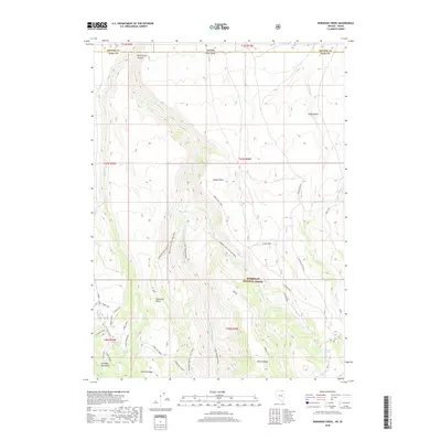
2018 Map of Robinson Creek
USGS Topo · Published 2018About this map
The E Fork Jarbidge River carves a deep path through this high-elevation landscape on the border of Idaho and Nevada. Located within the Humboldt National Forest, the terrain is defined by dramatic elevation changes between the Jarbidge Mountains and the arid expanse of the Inside Desert. Long-standing land use and migration patterns are evident in the network of named trails and forest roads, including the Robinson Hole Cutoff and the Altitude Trail. Distinctive topographic features like Sawmill Ridge, Palomino Bench, and Biroth Ridge suggest a history of local livestock grazing and timber management. Several water sources, such as Jim Bob Spring and Robinson Cr, provide critical points of interest in this remote section of Elko County, while canyons like Dove Creek Canyon mark the northern transition into Owyhee County.
Find a feature on this map
36 named features on this map. Tap any name to fly to it.
Don’t see what you’re looking for? This feature index may not catch every label — zoom into the map to look around manually.
Map Details
Editions of this 2018 Robinson Creek Map
This is the sole edition of this map. No revisions or reprints were ever made.
Other maps of this area

1943 · Jarbidge
USGS Topo · 1:62,500

1945 · Jarbidge
USGS Topo · 1:62,500

1955 · Twin Falls
USGS Topo · 1:250,000

1955 · Wells
USGS Topo · 1:250,000

1957 · Elk Mountain
USGS Topo · 1:62,500

1958 · Wells
USGS Topo · 1:250,000

1958 · Twin Falls
USGS Topo · 1:250,000

1961 · Wells
USGS Topo · 1:250,000
1979 · Dishpan
USGS Topo · 1:24,000
1979 · Three Creek
USGS Topo · 1:24,000