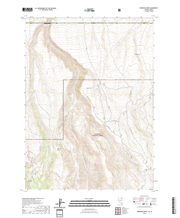
2021 Map of Robinson Creek
USGS Topo · Published 2021About this map
The E Fork Jarbidge River carves a deep path through this remote stretch of northern Elko County, where the high desert meets the northern extent of the Jarbidge Mountains. Located within the Humboldt National Forest, the terrain is defined by dramatic topographic shifts between the Inside Desert and deep incisions like Dove Creek Canyon.
Find a feature on this map
46 named features on this map. Tap any name to fly to it.
Don’t see what you’re looking for? This feature index may not catch every label — zoom into the map to look around manually.
Map Details
Editions of this 2021 Robinson Creek Map
This is the sole edition of this map. No revisions or reprints were ever made.
Other maps of this area

1943 · Jarbidge
USGS Topo · 1:62,500

1945 · Jarbidge
USGS Topo · 1:62,500

1955 · Twin Falls
USGS Topo · 1:250,000

1955 · Wells
USGS Topo · 1:250,000

1957 · Elk Mountain
USGS Topo · 1:62,500

1958 · Wells
USGS Topo · 1:250,000

1958 · Twin Falls
USGS Topo · 1:250,000

1961 · Wells
USGS Topo · 1:250,000
1979 · Dishpan
USGS Topo · 1:24,000
1979 · Three Creek
USGS Topo · 1:24,000