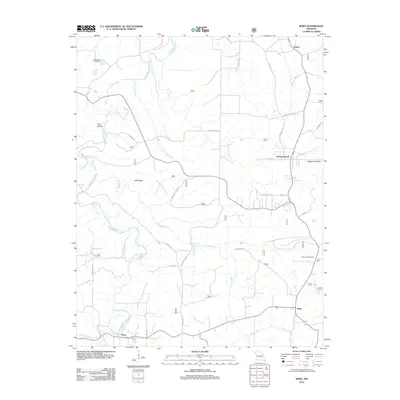
2012 Map of Roby
USGS Topo · Published 2012About this map
Plato and Roby anchor the southern reaches of this Ozark plateau landscape, where the terrain is deeply carved by the winding paths of Roubidoux Creek and Little Piney Creek. The map reveals a rural network of named ridge roads and forest tracks, such as St Anna Rd and Forestry Lane 1526, connecting small settlements like Evening Shade and Palace. Geologic features define the character of the land, notably at Daniels Sinkhole and the sheltered Pine Hollow. For those researching local heritage, the inclusion of Macedonia Cemetery and Cook Cemetery provides critical geographic anchors for family history. The Roby Lookout Tower stands as a prominent landmark on the eastern heights, overlooking a region where the drainage patterns of Rock Creek and Prairie Creek dictate the placement of early homesteads and modern routes alike.
Find a feature on this map
33 named features on this map. Tap any name to fly to it.
Don’t see what you’re looking for? This feature index may not catch every label — zoom into the map to look around manually.
Map Details
Editions of this 2012 Roby Map
This is the sole edition of this map. No revisions or reprints were ever made.
Other maps of this area

1931 · Manes
USGS Topo · 1:48,000

1941 · Big Piney
USGS Topo · 1:62,500

1941 · Manes
USGS Topo · 1:62,500

1941 · Bado
USGS Topo · 1:62,500

1943 · Big Piney
USGS Topo · 1:62,500

1943 · Manes
USGS Topo · 1:62,500

1943 · Drynob
USGS Topo · 1:62,500

1943 · Bado
USGS Topo · 1:62,500

1954 · Springfield
USGS Topo · 1:250,000

1954 · Drynob
USGS Topo · 1:62,500