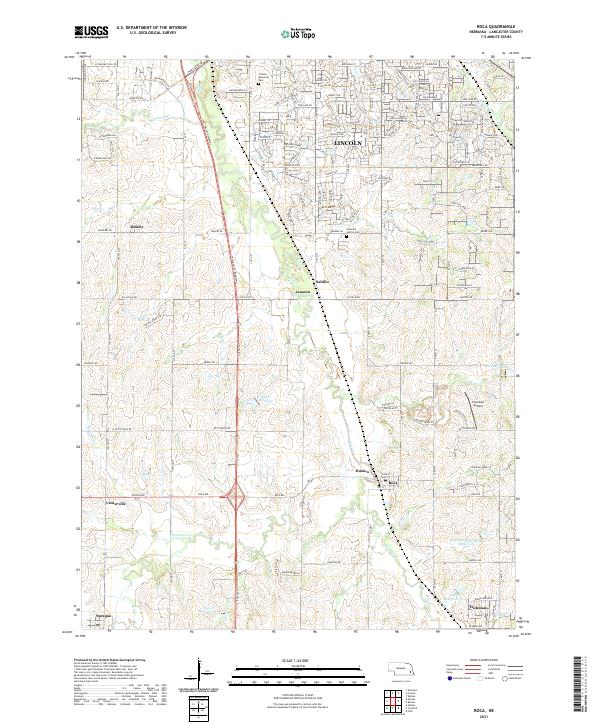
2021 Map of Roca
USGS Topo · Published 2021About this map
Lincoln's southern suburban expansion meets the rural character of Lancaster County in this contemporary survey of the Salt Creek watershed. The landscape is defined by a series of flood control structures and reservoirs, including Salt Creek Reservoir 1-A and Roca Subwatershed Reservoir, which manage the drainage of Wittstruck Creek and Hickman Branch. These water management features are interspersed with historical settlements such as Jamaica, Saltillo, and Hanlon, each reflecting the region's agricultural roots.
Find a feature on this map
87 named features on this map. Tap any name to fly to it.
Don’t see what you’re looking for? This feature index may not catch every label — zoom into the map to look around manually.
Map Details
Editions of this 2021 Roca Map
This is the sole edition of this map. No revisions or reprints were ever made.
Other maps of this area

1897 · Lincoln
USGS Topo · 1:125,000

1955 · Lincoln
USGS Topo · 1:250,000

1957 · Lincoln
USGS Topo · 1:250,000

1958 · Lincoln
USGS Topo · 1:250,000

1964 · Cortland
USGS Topo · 1:24,000
1964 · Hallam
USGS Topo · 1:24,000

1964 · Denton
USGS Topo · 1:24,000

1964 · Roca
USGS Topo · 1:24,000

1964 · Walton
USGS Topo · 1:24,000
1964 · Emerald
USGS Topo · 1:24,000