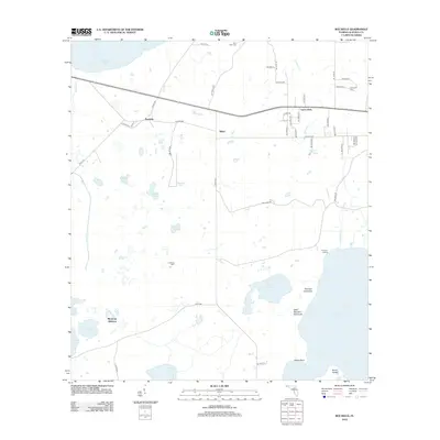
2012 Map of Rochelle
USGS Topo · Published 2012About this map
Orange Lake and Lochloosa Lake anchor the southern reaches of this landscape, where the flatlands of Alachua County meet complex wetlands and hammocks. Small communities such as Rochelle, Grove Park, and Phifer are situated along the east-west corridor, while Micanopy Junction lies to the southwest near Lowman Pond and Hay Lake. The area is defined by its hydrography, including the winding path of Lochloosa Cr and the engineered route of Camps Canal.
Find a feature on this map
59 named features on this map. Tap any name to fly to it.
Don’t see what you’re looking for? This feature index may not catch every label — zoom into the map to look around manually.
Map Details
Editions of this 2012 Rochelle Map
This is the sole edition of this map. No revisions or reprints were ever made.
Other maps of this area

1890 · Arredondo
USGS Topo · 1:62,500

1892 · Arredondo
USGS Topo · 1:62,500

1893 · Citra
USGS Topo · 1:62,500

1894 · Arredondo
USGS Topo · 1:62,500

1895 · Williston
USGS Topo · 1:62,500

1895 · Citra
USGS Topo · 1:62,500

1938 · Hawthorn
USGS Topo · 1:48,000

1943 · Hawthorn
USGS Topo · 1:62,500

1954 · Gainesville
USGS Topo · 1:250,000

1958 · Gainesville
USGS Topo · 1:250,000