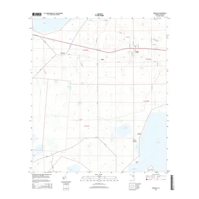
2015 Map of Rochelle
USGS Topo · Published 2015About this map
Newnans Lake and Orange Lake anchor the north and south of this wetlands landscape, where the flat Florida terrain is defined by an intricate network of cypress strands and prairies. In 2015, the small community of Rochelle sits at a historic crossroads between Prairie Creek and the western edge of Watson Prairie. This area is characterized by its numerous named water bodies, including Gamble Pond, Tillmans Pond, and Lowman Pond, illustrating a drainage pattern that feeds the larger lake basins.
Find a feature on this map
59 named features on this map. Tap any name to fly to it.
Don’t see what you’re looking for? This feature index may not catch every label — zoom into the map to look around manually.
Map Details
Editions of this 2015 Rochelle Map
This is the sole edition of this map. No revisions or reprints were ever made.
Other maps of this area

1890 · Arredondo
USGS Topo · 1:62,500

1892 · Arredondo
USGS Topo · 1:62,500

1893 · Citra
USGS Topo · 1:62,500

1894 · Arredondo
USGS Topo · 1:62,500

1895 · Williston
USGS Topo · 1:62,500

1895 · Citra
USGS Topo · 1:62,500

1938 · Hawthorn
USGS Topo · 1:48,000

1943 · Hawthorn
USGS Topo · 1:62,500

1954 · Gainesville
USGS Topo · 1:250,000

1958 · Gainesville
USGS Topo · 1:250,000