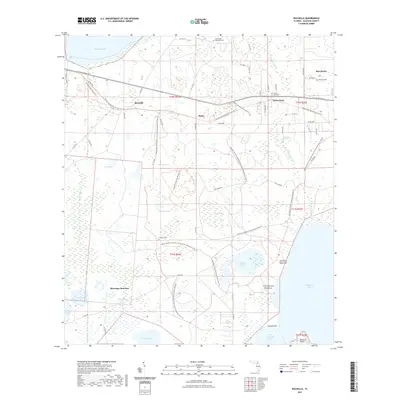
2021 Map of Rochelle
USGS Topo · Published 2021About this map
Rochelle and Phifer sit at the center of this landscape defined by the transition from the pine flatwoods of north-central Florida to the expansive wetlands and lake basins of Alachua County. The area is characterized by a complex network of conservation lands and trails, including the Gainesville-Hawthorne State Trl and the Lochloosa Wildlife Conservation Area Trl. These corridors connect small settlements like Grove Park and Micanopy Junction while skirting the edges of significant water bodies such as Orange Lake, Newnans Lake, and Lochloosa Lake. Local history is preserved in small burial grounds like Saint Paul Memorial Cem and Coleman Cem, which are scattered throughout the hammock and prairie lands. Notable landmarks like Magnesia Springs and Garrison Hammock indicate the specific ecological and cultural features that have long influenced the development of this region east of the Paynes Prairie basin.
Find a feature on this map
45 named features on this map. Tap any name to fly to it.
Don’t see what you’re looking for? This feature index may not catch every label — zoom into the map to look around manually.
Map Details
Editions of this 2021 Rochelle Map
This is the sole edition of this map. No revisions or reprints were ever made.
Other maps of this area

1890 · Arredondo
USGS Topo · 1:62,500

1892 · Arredondo
USGS Topo · 1:62,500

1893 · Citra
USGS Topo · 1:62,500

1894 · Arredondo
USGS Topo · 1:62,500

1895 · Williston
USGS Topo · 1:62,500

1895 · Citra
USGS Topo · 1:62,500

1938 · Hawthorn
USGS Topo · 1:48,000

1943 · Hawthorn
USGS Topo · 1:62,500

1954 · Gainesville
USGS Topo · 1:250,000

1958 · Gainesville
USGS Topo · 1:250,000