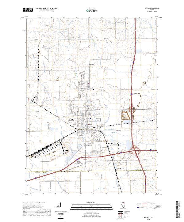
2024 Map of Rochelle
USGS Topo · Published 2024About this map
Rochelle serves as the central hub of this northern Illinois landscape, where the convergence of major transit corridors meets a complex network of agricultural drainage and natural waterways. The city's northern expansion is marked by the village of Hillcrest, while the small settlement of Flagg Center sits to the west. This modern survey illustrates the intensive water management of the region, featuring engineered waterways like the North Creston Ditch, Banning Lateral, and Sullivan Lateral that crisscross the prairie to support the surrounding farmland.
Find a feature on this map
121 named features on this map. Tap any name to fly to it.
Don’t see what you’re looking for? This feature index may not catch every label — zoom into the map to look around manually.
Map Details
Editions of this 2024 Rochelle Map
This is the sole edition of this map. No revisions or reprints were ever made.
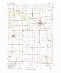
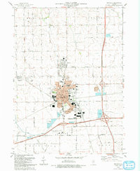
Historical Maps of Dement Township Through Time
4 maps found